
Hurricane Joaquin arrive in 5 days. Heightened alert for Britain
Hurricane Joaquin, the worst autumn storms in 30 years, gathers strength on its track across the Atlantic
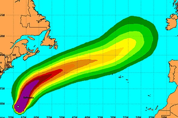
Worried forecasters have in the past few hours issued fresh warnings ahead of the churning vortex making landfall with the UK in just five days. Latest weather models show the category-4 storm, currently unleashing 140mph-plus gales off the coast of the United States rapidly strengthening as it moves towards the UK. Rather than losing energy on its path across the cool Atlantic waters, experts warn instead it is becoming more powerful driven by the Sun and the jet stream. Britain could be in the firing line for a catastrophic battering worse even than the historic storm of October 1987 if Joaquin continues on its current track. Piers Corbyn, forecaster for WeatherAction, said exceptionally strong solar activity in the western Atlantic is charging the storm on its UK-bound journey.
Source:

Hurricane Joaquin: UK on heightened alert for autumn SUPERSTORM | Weather | News | Express.co.uk
Read Also: