
Storm Barbara, expected on Friday in UK
After recent relatively quiet and dry conditions, much more unsettled weather is heading our way in the lead-up to Christmas with the second named storm of the season, Storm Barbara, expected on Friday.
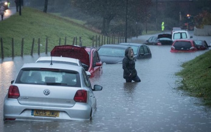
As many plan festive visits to friends and family this week, the weather is getting more disturbed. The windiest and wettest weather will be in the north and west of the UK with National Severe Weather Warnings in place. Stormy weather on Friday and into Saturday has been named Storm Barbara, the second named storm of the 2016-17 season. Other parts of the UK are also expected to see increasingly windy weather as the week progresses.
Deputy Chief Meteorologist, Chris Tubbs said: “Storm Barbara is forecast to form in the west Atlantic on Wednesday and will pass close to the northwest of the UK during Friday, bringing very strong winds and heavy rain, especially across the north and west of Scotland. This brings the potential for some structural damage, disruption to power supplies and travel, with restrictions on bridges and disruption to ferries likely.
“The disturbed conditions look like continuing through Christmas weekend with another vigorous low pressure system waiting in the wings. So, whatever your plans over the next few days it’s worthwhile staying up to date with the latest Met Office forecasts, which is easy to do on our app.”
The wet and windy weather, which is as a result of a succession of deep Atlantic low pressure systems, gets underway today (20 December) with the northwest expecting a band of rain, heavy at times. There will also be strengthening winds which could reach severe gale force in the extreme northwest of Scotland.
A Yellow wind warning has also been issued for Wednesday (21 December) covering north and northwest Scotland. Here frequent blustery showers will occur, often accompanied by thunder and lightning and these showers will turn increasingly wintry even to low levels. Meanwhile a front will bring rain to parts of the south of England.
An Amber wind warning has been issued for Friday (23 December) covering northern and western parts of Scotland for Friday afternoon, evening and overnight into Christmas Eve (Saturday). A separate yellow wind warning covering northern parts of the UK is also in place. South or southwesterly winds will strengthen across the whole country, but gusts of 60 to 70 mph are likely quite widely in the warning areas, with westerly winds gusting 80 to 90 mph likely across parts of western and northern Scotland later on Friday and overnight into Saturday. Winds will then ease on Saturday morning.
However, there will still be some periods of less unsettled and stormy weather over the coming days, with drier, less windy and brighter conditions on Thursday and Saturday. As always its best to check the latest forecast before you travel.

RAC Traffic Watch spokesman Rod Dennis said: “The weather is taking a decided turn for the worse as we near Christmas itself, and drivers are going to need to be on their guard. Heavy downpours and extremely gusty winds will join forces to make the going tough for anyone driving on Friday especially. Early indications are that more storms could also roll in in the days to come.
“Anyone wanting to avoid the worst conditions on the roads should look for the calmer weather windows – right now, Thursday and the afternoon of Christmas Eve look better, but we urge drivers to keep a close eye on the forecast and plan any longer trips carefully.”
Keep up to date with the weather using our forecast pages and by following us onTwitter and Facebook, as well as using our new mobile app which is available for iPhone from the App store and for Android from the Google Play store. Search for “Met Office” in store.
You can now keep track of the weather across a number of locations using our App. You can use the ‘day’ view during the countdown to Christmas or the ‘hourly’ view, to help you plan out your day.
For more information on preparing for winter, please check the Met Office Get Ready for Winter pages.
Why has the weather changed?
Recent conditions in North America – with cold Arctic air sinking far southwards – has brought unusually cold weather to parts of North America. This cold air encounters relatively warm air in the western Atlantic. This creates a strong temperature gradient along the boundary between the two air masses which will strengthen the jet stream – a high-altitude fast-flowing wind which often brings low-pressure systems and storms to our shores. As the jet stream then comes east across the Atlantic, it drives areas of low pressure towards the UK, with associated spells of strong winds and rain.
Storm names for 2016/2017 are:
| Letter | Storm name | Letter | Storm name |
|---|---|---|---|
| A | Angus | N | Natalie |
| B | Barbara | O | Oisin |
| C | Conor | P | Penelope |
| D | Doris | Q | * |
| E | Ewan | R | Robert |
| F | Fleur | S | Susan |
| G | Gabriel | T | Thomas |
| H | Holly | U | * |
| I | Ivor | V | Valerie |
| J | Jacqui | W | Wilbert |
| K | Kamil | X | * |
| L | Louise | Y | * |
| M | Malcolm | Z | * |
*Names for these letters are not included in line with the US National Hurricane Centre naming convention (Source: Met Office)